PHOENIX — Extreme heat is returning to Arizona!
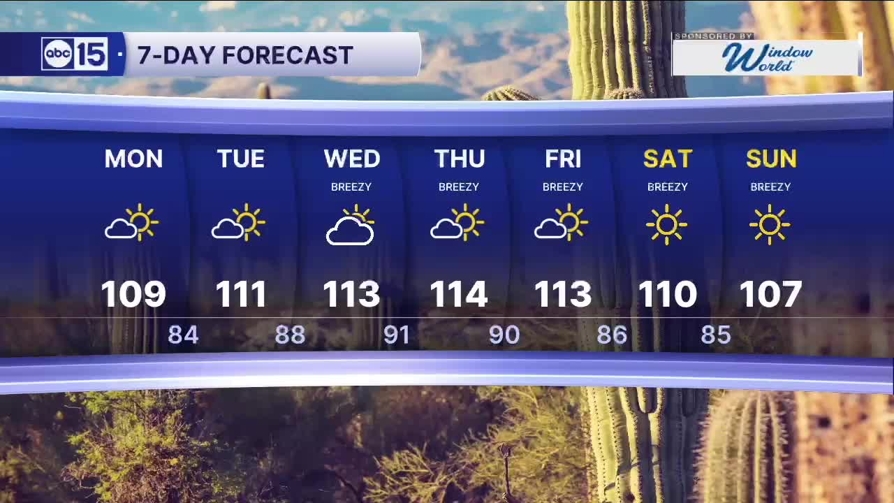
A powerful ridge of high pressure is building over the Desert Southwest, pushing Valley highs back toward 110 degrees starting today. Temperatures could reach 115 by Thursday.
Read more Buckeye police arrest man after deadly shooting involving cousins
Heat risk levels are climbing, too. A moderate heat risk is in place through Tuesday before escalating to a major heat risk for the rest of the work week.
An Extreme Heat Warning is in effect for the Grand Canyon below 4,000 feet Monday and Tuesday. An Extreme Heat Watch takes effect Tuesday across parts of southern Arizona, then expands to the Phoenix metro on Wednesday.
With dangerous heat on the way, Wednesday and Thursday are ABC15 Weather Action Days.
Read more Man in custody after shooting leaves 2 injured near 19th and Peoria avenues
The most important step is staying hydrated. Limit time outside from 11 a.m. to 6 p.m., when heat peaks for the day. If you head outside during that window, wear lightweight, light-colored clothing and don’t skip the sunscreen. Take frequent breaks in shade or air conditioning to cool down.
That same ridge may also begin drawing monsoon moisture into Arizona by mid-to-late week, bringing a storm chance to the high country.
Winds will increase through the work week as well. Gusts could top 30 mph in the Valley and exceed 40 mph across higher terrain by Friday.
Read more Vance and Iranian officials arrive in Switzerland to launch talks on Tehran’s nuclear program