 By admin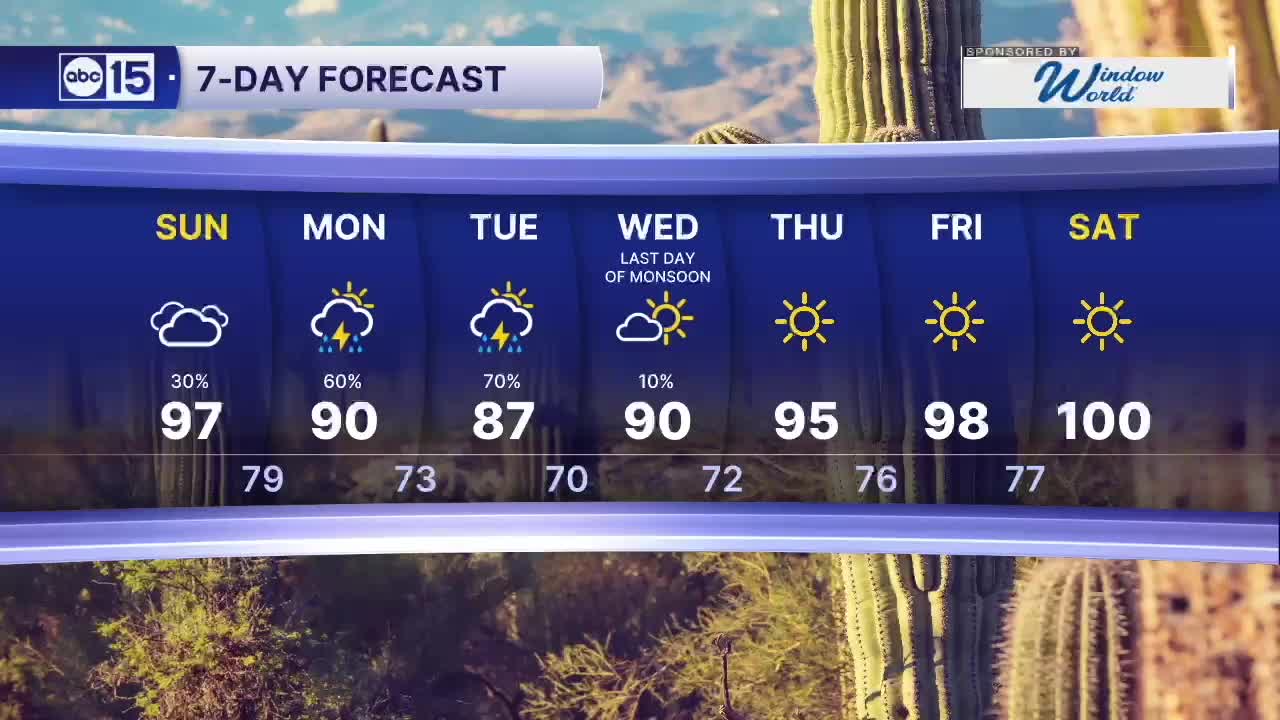
PHOENIX — Get ready for some big changes as rain chances ramp up across Arizona over the next several days.
Read more Victims in deadly Gila County flooding reflect on year anniversary
Clouds will move in Saturday night as moisture from the remnants of Hurricane Odalys streams into the state. Scattered showers and a few embedded thunderstorms could develop in the Valley and across central Arizona by Sunday afternoon and evening.
Rain and thunderstorm chances ramp up Monday and Tuesday as a storm system approaches from the west and moisture from Hurricane Polo moves in, adding fuel to our storm chances and bringing an increased risk of heavy downpours.
Early estimates show that parts of the Valley could pick up a half inch to an inch of rain, with higher totals in the high terrain north and east of Phoenix.
Flood Watches are now in effect from Sunday night to Tuesday night for areas across northern Arizona, and from Monday morning to Tuesday night for areas across southeast Arizona. Remember to “Turn Around, Don’t Drown” and avoid trying to drive through any flooded roadways or washes.
Read more One person hurt in shooting involving authorities near Rock Springs Cafe Friday
Valley highs will drop to the 80s to low 90s on Monday and Tuesday as our rain chances usher in a significant cool down.
Drier air returns by Wednesday, which is last official day of the monsoon season.
As we dry back out, temperatures will climb into the upper 90s by the end of next week.
Read more Woman’s body found in submerged truck pulled from Mesa canal near Signal Butte Road