PHOENIX — It’s been a hot start to the week!
Phoenix ended up just one degree shy of the daily heat records on Monday and Tuesday as high pressure sat overhead.
Read more WATCH: 102-year-old Navy veteran draws from lessons of three wars to create art
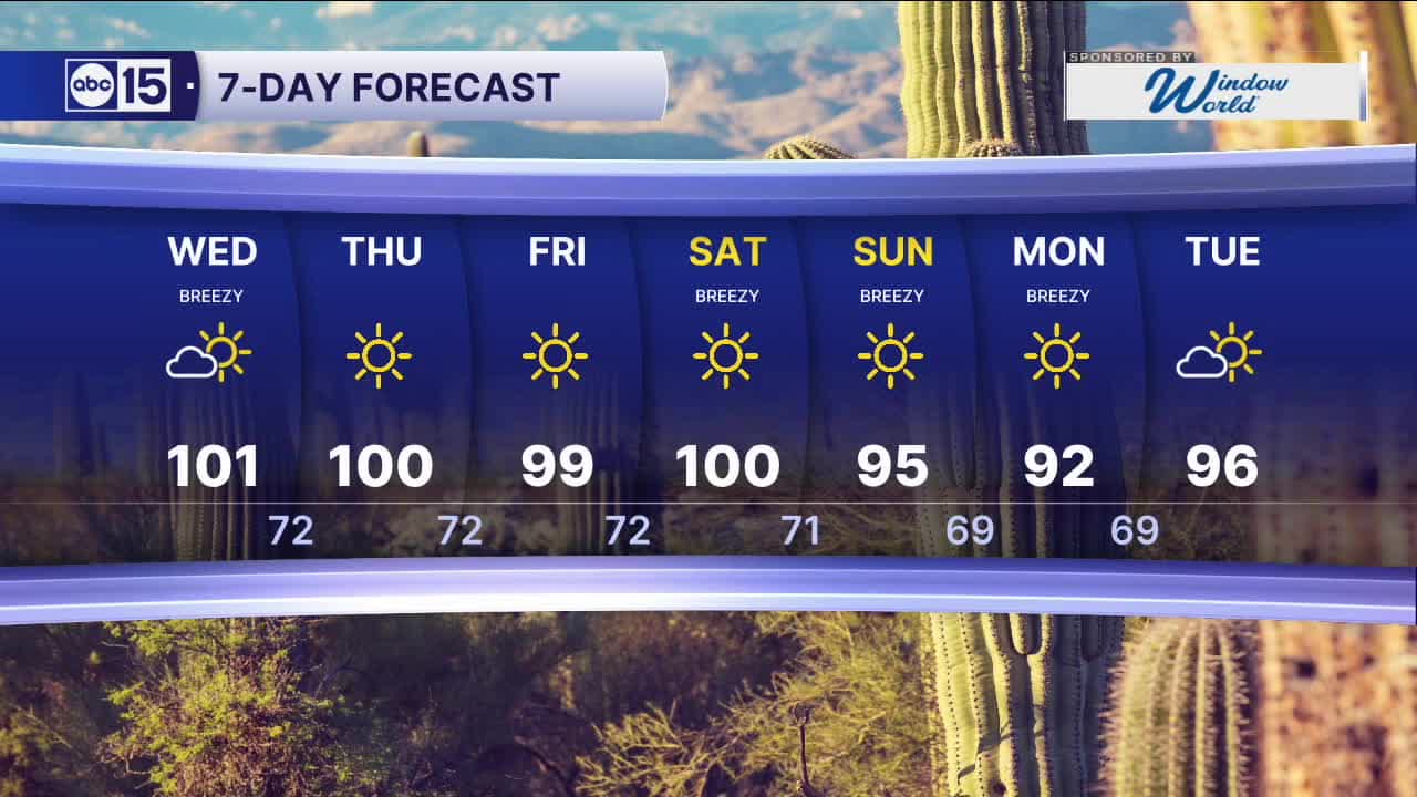
That ridge of high pressure is now slowly moving east as low pressure approaches from the southwest, so temperatures will start to drop and winds will pick up across Arizona.
Gusts could top 25 mph in the Valley Wednesday afternoon with gusts near 40 mph across the high country.
As conditions stay dry, fire danger is increasing as those winds pick up.
Red Flag Warnings for potential wildfire danger are in effect across northern Arizona, including many areas along the Mogollon Rim, on Wednesday.
Read more Arizona’s tallest water slide ‘Riptide’ opens at Golfland Sunsplash in Mesa
Here in the Valley, the increase in afternoon winds should limit ozone pollution and lead to better air quality on Wednesday. But, High Pollution Watches are in effect Thursday and Friday as winds die down.
Temperatures will stay near 100 through the end of the week with overnight lows in the upper 60s to low 70s.
We could drop out of the triple digits by Sunday, with highs falling below the seasonal average of 95 degrees early next week.
Read more Auditor’s report shows more gaps in ESA program’s financial accountability