 By admin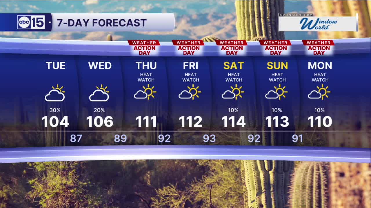
PHOENIX — Scattered storm chances will stick around across Arizona today.
A Flood Watch is in effect today for much of northern, eastern, and southern Arizona. Heavy rain may lead to flash flooding, especially near burn scars and low-lying crossings. Never drive through flooded roadways.
Read more WATCH: Chandler Police Department getting a new forensics lab
Storms developing along the Mogollon Rim could send outflows into the Valley this evening just like on Monday, kicking up gusty winds and blowing dust before any rain arrives.
Storm chances then back off for the rest of the work week.
High pressure will intensify late in the week, sending temperatures soaring and limiting our rain chances.
Read more Prescott homeless veteran housing gets major boost worth millions
An Extreme Heat Watch has been issued for central and western Arizona (this includes the Valley) Thursday through next Monday, as temperatures will range between 108 and 115 degrees each day, with overnights jumping into the low 90s each night.
With extreme heat returning, we have issued ABC15 Weather Action Days from Thursday through Monday.
Read more Trump says Netanyahu won’t face arrest if he visits NYC, downplaying Mamdani’s threat